 There seem to be many of you out there who are embracing again the art of navigating using map and compass techniques. We find that one of the hardest skills to master is the visualisation of the terrain around us using just contour information from the map.
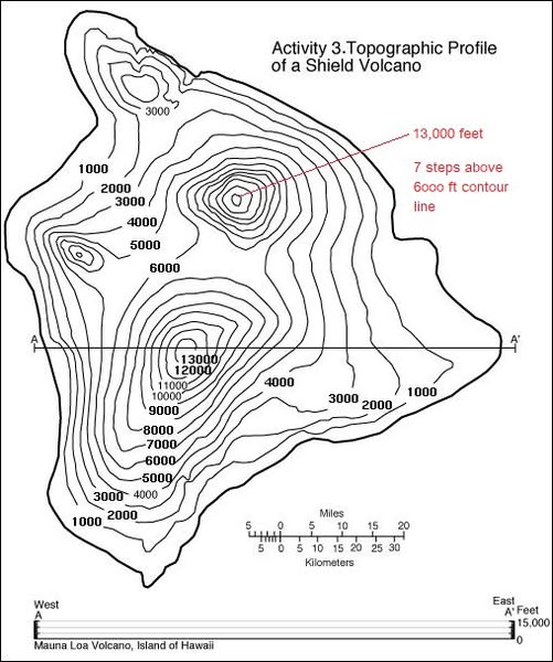
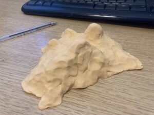
One trick that Si uses is to obtain (or pinch off the kids!) some Plasticine or equivalent to make a simple 3D model of a contour map. Here, he’s used a contour only representation of the Mauna Loa volcano on Hawaii and set himself 15 mins to sculpt a rough approximation of the topography.
If you have OS Maps, and a PC, you could zoom in on a chosen area of interest and try the same exercise. Then, in the 3D mapping mode, you can see how accurate your model is!
 Top tips, start simple – maybe just a single prominence first. Then work up to more complex terrain featuring cols, spurs and re-entrants. Set a time limit but use the first couple of minutes for just looking at and understanding the 2D map first. Don’t overthink things – just a basic representation will do. Make sure you have a means to check what the contours actually look like in real life – as already mentioned, OS Maps has a 3D feature.
Go on, unleash the Michelangelo in yourself…